Recently, I hiked 35 miles across North Cascades National Park, to the wilderness-edge town of Stehekin. I got there earlier than I planned, and had some time to explore and enjoy the little mountain town. Luckily, they have a bike rental business! 🙂
Stehekin can only be reached on foot, by boat, or by plane, so there isn’t an extensive network of roads. In fact, there’s one road, about 15 miles long, and paved for 1 of those miles. A shuttle van goes between town and a backcountry camp called High Bridge, 11 miles out of town, 4 times a day. I took my rental bike on the shuttle, and rode back into town.

Following the Stehekin River into town
Stehekin Valley Road is an old wagon trail, and now a dirt and gravel road. I’m not very used to this type of surface or the wide tires, so I went slowly, and enjoyed the wonderful scenery. It took me three days to get to the town from the Cascade Pass trailhead, and now I was moving at a luxurious pace.

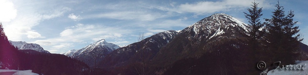
Where the mountains meet the meadows
Stehekin sits near the western edge of Lake Chelan, a 50 mile long finger lake. The western edge is a special shade of blue green, because it drains 27 glaciers. That’s not apparent in the photo below, from this angle the lake reflects the sky. But the lake signals the edge of the town, and the end of the ride.

Approaching town, at the edge of the lake
This was a fun ride, and exactly what I needed. Next time I visit Stehekin, though, I’ll probably spend my time there hiking. But I’d recommend doing it once to anybody who finds themselves in the area.


